Chao news client reporter Fang Li
Recently, it has been overcast with rain in Zhejiang Province, with obvious rain today (February 3-4), and the precipitation was suspended on the 5th, and the freezing rain and snow weather resumed on the 6th-7th.
Let’s stick to it for a few more days. Judging from the current weather situation, the weather in Zhejiang on New Year’s Eve was good, accompanied by sunshine, and the temperature began to rise.

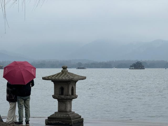
West Lake misty rain user sea photo
Affected by cold air, the daytime was still cold yesterday. At 15 o’clock yesterday, the temperature in all parts of Zhejiang was low. Huzhou was only 2.9℃, and southern Zhejiang was relatively warmer. The temperature in many areas dropped by more than 10℃ compared with the same time the day before. At night, the water vapor strengthened again and the rain increased again.
Today, there are sometimes showers in cloudy weather in the whole province, and more rain will appear tomorrow, with moderate rain and partial heavy rain in the whole province.
For example, in Hangzhou, due to the eastward movement of the deep south branch trough, the Jianghuai cyclone was also born in the southwest airflow in front of the trough and the easterly airflow at the bottom of the northern high pressure. At the same time, the water vapor condition of precipitation in Hangzhou has been strengthened and the dynamic conditions have become more sufficient. The whole city of Hangzhou will experience moderate rain and partial heavy rain.
In the next few days, the rain will stop all over the province on the 5 th, mainly cloudy weather. However, due to the influence of multiple cold air, the temperature will drop further.
The coldest day is February 6, and it is predicted that Zhejiang will join the "ice and snow group chat" on this day.
Since the 6th, the warm and humid air flow has been strengthened again, and combined with the low temperature, it is easy to change the phase of rain and snow.
In the morning, the temperature fell below the freezing point again, and the lowest temperature in most parts of the province was 0 ~-2 C with thin ice and-3 ~-5 C with freezing. The highest temperature during the day is only about 2℃ in northern Zhejiang.
It is estimated that there will be sleet or snow in the mountainous areas of central and northern Zhejiang on June 6-7, and there will be sleet locally in the plain areas.
The rainy weather in Zhejiang will last until the 7th, and it will turn cloudy to cloudy on the 8th.
From this point of view, despite the baptism of rain and rain before the festival, on New Year’s Eve, we can finally be accompanied by winter sunshine.

Hangzhou’s red wall Bai Mei netizen sea photo
Let’s draw the key points again-
It was rainy in our province before New Year’s Eve, and there was low temperature, rain and snow freezing in the mountains on June 6-7. 2-5 days, there is a wide range of rain, snow and freezing weather in central and eastern China.Friends who have plans to return home should plan their itinerary in advance to ensure safe travel.
Medium-range weather forecast
4th (Sunday): There is moderate rain in the whole province, and partial heavy rain in northern and western Zhejiang.
5th (next Monday): The whole province is cloudy.
Day on the 6th (next Tuesday): It is cloudy to cloudy in the southwest of Zhejiang, and it turns cloudy with light rain in the afternoon; Cloudy to cloudy in other areas.
6th night-7th (next Wednesday): There is little to moderate rain in the province, and there is sleet or light snow in the mountainous area of central and northern Zhejiang.
8th (next Thursday): The northern part of Zhejiang is cloudy to cloudy, while the rain in other areas gradually stops and turns cloudy.
9th (next Friday): Cloudy to sunny in the whole province.
"Reprint please indicate the source"
关于作者